How High Is Mount Toubkal? Height, Summit, and Mountain Facts
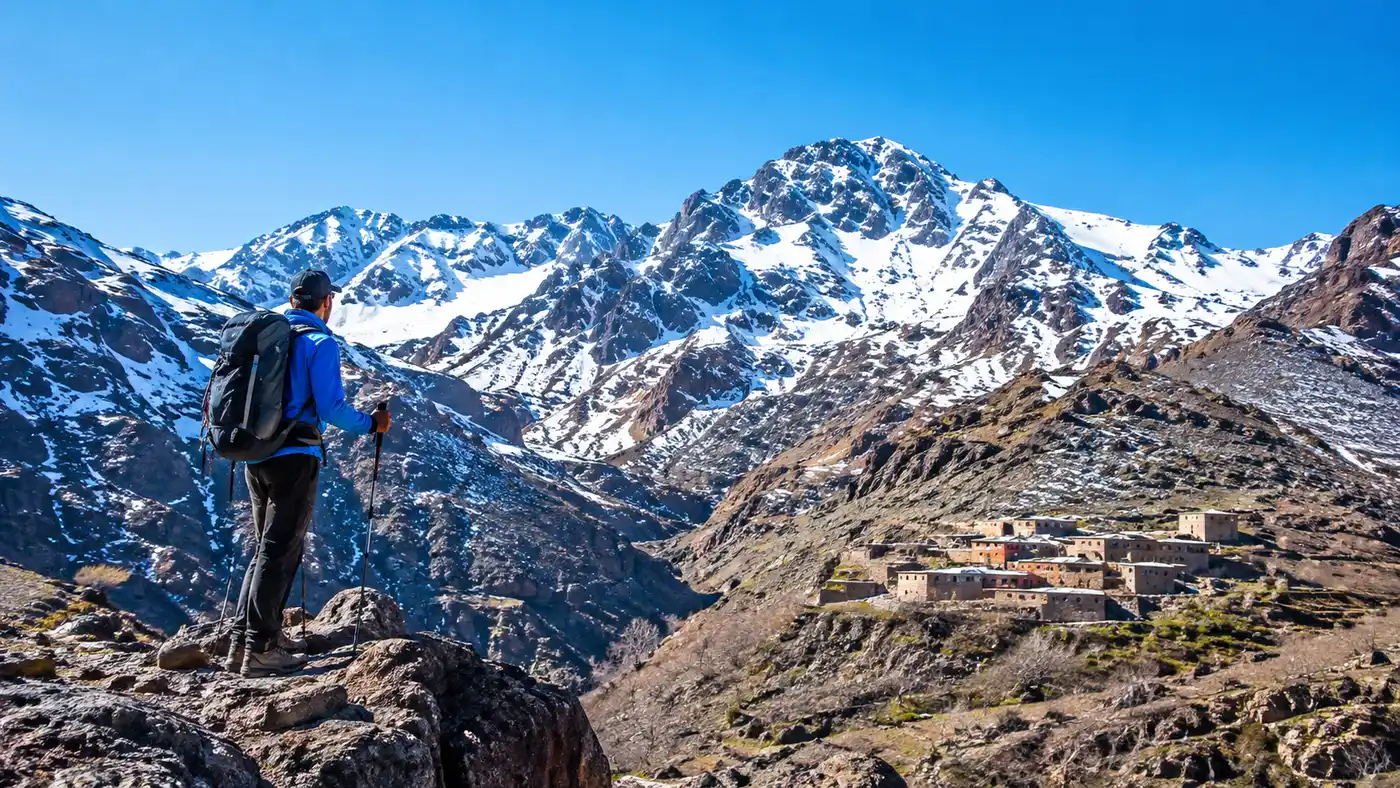
When you drive out of Marrakech toward the south, the wall of red and grey rock looks almost like a painted backdrop against the horizon. Most travelers staring out the dusty window of a grand taxi ask the same basic question: how high is mount toubkal? The answer you get from local drivers is usually a casual "four thousand meters," tossed out with a wave of the hand as if that rounded figure explains what waits up there.
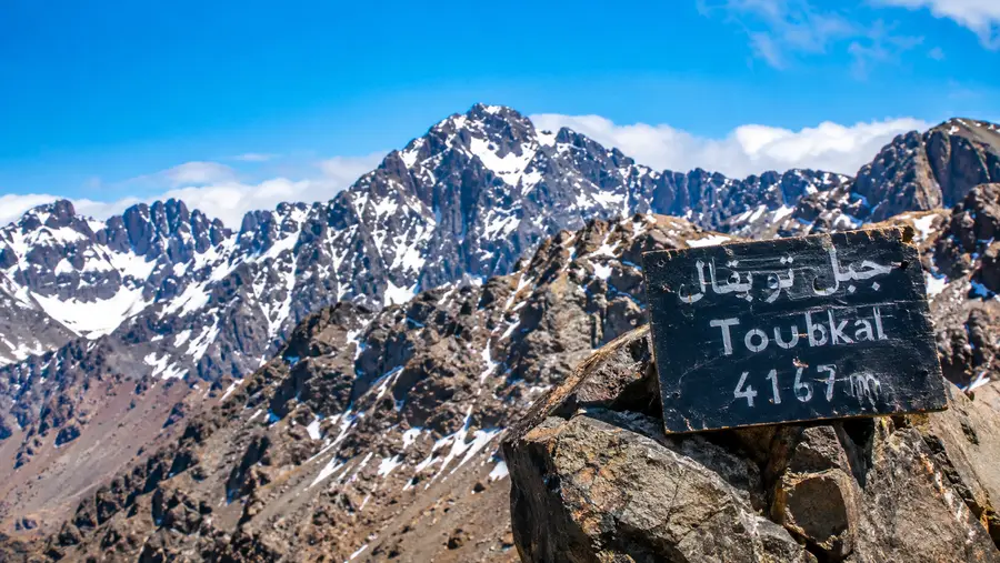
The real figure is 4,167 meters, which works out to 13,671 feet. That single measurement makes it the highest mountain in Morocco and the undisputed highest peak in North Africa. Yet raw numbers on a phone screen rarely prepare your lungs for what happens on the final scree slope at six in the morning, where every three paces feel like an negotiation with your own calves.
Book your mount toubkal trek experience:
How High Is Mount Toubkal in Meters and Feet?
Survey records settle on 4,167 meters (13,671 feet) for the toubkal height. You will occasionally spot 4,165 meters on yellowing French colonial maps from the 1930s, or 4,168 meters on an old Soviet topographic sheet. Modern GPS readings, though, stick firmly to 4,167. For mountain lovers counting prominence, Toubkal boasts an isolation of over 2,000 kilometers before you hit peaks of equal height in the Alps or East Africa.
At the mount toubkal summit, there is no razor-edge ridge of pristine alpine granite. What greets you instead is an enormous, three-legged metal pyramid built by French cartographers back in 1931. It looks like an abandoned radio mast or an oversized iron tripod pinned straight into the rock. Trekkers have plastered it with stickers from European climbing clubs, faded ribbons, and weather-beaten Berber flags. The metal frame hums loudly when the wind picks up from the Atlantic, which happens almost every day around noon.
The ground beneath the tripod is a wide, tilted plateau scattered with broken basalt and loose shale. It is large enough that fifty people could wander around without bumping into each other. If you stand on the southern lip of the plateau, the drop into the valley below is dizzying. You can stare down into barren canyons that look like photos sent back from Mars.
Note: Handheld GPS units at the summit frequently read anywhere between 4,160 and 4,180 meters depending on satellite geometry and cloud cover. Do not panic if your watch claims you came up 10 meters short of the official mark.
Toubkal Height Compared to Other Atlas and African Peaks
People often forget that the Atlas chain is massive. It stretches roughly 2,500 kilometers across Morocco, Algeria, and Tunisia, but the truly monster elevations cluster together in the High Atlas sub-range right here in central Morocco. Toubkal is the tallest mountain in Morocco, but its neighbors are not far behind. Ouanoukrim sits just across the valley and has two distinct summits, Timesguida and Ras Ouanoukrim, both clearing 4,000 meters easily.
Outside of Morocco, North Africa has nothing that competes. Algeria reaches its high point at Mount Tahat in the Hoggar Mountains, but that peak tops out at 2,908 meters. You have to travel thousands of miles southeast to the East African Rift to find taller ground. Toubkal does not match Kilimanjaro or Mount Kenya in absolute stature, yet its rise above the dry Marrakech plains is steeper and more abrupt than many people anticipate.
| Peak Name | Region / Country | Elevation (Meters) | Elevation (Feet) | Significance |
|---|---|---|---|---|
| Mount Toubkal | High Atlas, Morocco | 4,167 m | 13,671 ft | Highest mountain in North Africa |
| Timesguida (Ouanoukrim) | High Atlas, Morocco | 4,089 m | 13,415 ft | Second highest peak in Morocco |
| Ras Ouanoukrim | High Atlas, Morocco | 4,083 m | 13,395 ft | Third highest peak in Morocco |
| M'Goun | Central High Atlas, Morocco | 4,071 m | 13,356 ft | Isolated ridge massif to the east |
| Mount Tahat | Hoggar Mountains, Algeria | 2,908 m | 9,541 ft | Tallest mountain in Algeria |
| Mont Blanc | Graian Alps, France/Italy | 4,808 m | 15,774 ft | Highest peak in Western Europe |
| Mount Kilimanjaro | Tanzania | 5,895 m | 19,341 ft | Highest peak on African continent |
When you stand beside that iron pyramid, looking east toward M'Goun, the sheer density of ridgelines becomes clear. It is not just one lonely volcanic spike rising out of the desert. The High Atlas is a crushed, folded barrier of ancient seabed and volcanic intrusions thrown up when the African tectonic plate shoved itself into Europe millions of years ago.
What It Actually Feels Like at the Toubkal Summit
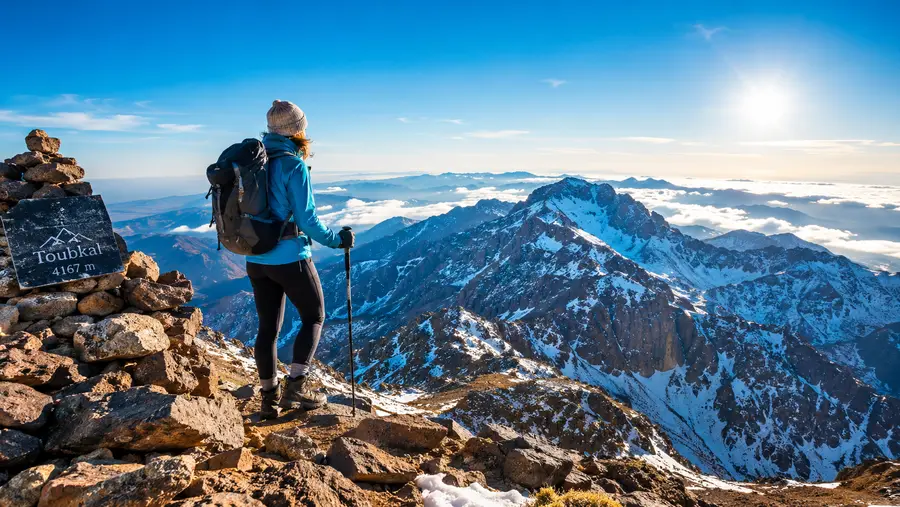
Standing at 4,167 meters means you are breathing air that holds about 40 percent less effective oxygen per breath than what you get on a beach in Essaouira. You notice it instantly. Simple things like pulling your camera from your backpack or tightening a bootlace make your heart beat in your throat. Mild headaches are common. Most people who hike up from the refuge feel a slight fuzziness behind the eyes, which usually lifts once they drink water and chew on some dried dates.
The drop in temperature catches unprepared hikers off guard. If it was 32 degrees Celsius down in Marrakech when you left, it might be 3 degrees at the top at dawn, even in July. In January or February, the toubkal summit frequently drops to minus 15 degrees Celsius before wind chill gets factored into the equation. Ice clings to the metal markers, and wind howls across the South Col with genuine ferocity.
If you want to know what to pack and how to train for that thin atmosphere, checking a thorough breakdown of Mount Toubkal trek difficulty, fitness, and kit list will save you from hauling unnecessary weight up three thousand vertical feet of loose rock. Packing too heavy is the single easiest mistake to make here.
Pro tip: Keep your phone inside an interior fleece pocket close to your chest on the summit push. The cold air at 4,000 meters drains lithium batteries from 80% to zero in less than twenty minutes.
Book your mount toubkal trek experience:
Elevation Profile: From Marrakech to the Toubkal Summit
The climb itself does not start at sea level, which is a blessing for your legs. Most journeys begin in Marrakech, sit at a modest elevation, and then climb through tight gorges by vehicle before you ever step foot on dirt. The transition from palm groves to cold scree happens over a surprisingly short horizontal distance.
- Marrakech: 466 meters (1,529 ft). Hot, dusty, and full of scooter exhaust. You leave early in the morning by road.
- Imlil village: 1,740 meters (5,708 ft). The main trailhead hub where walnut trees shade stone guest houses and mule packs get organized.
- Sidi Chamarouch shrine: 2,310 meters (7,578 ft). A tiny settlement clustered around a whitewashed sacred rock where hikers stop for freshly squeezed orange juice.
- Toubkal refuges (CAF and Les Mouflons): 3,207 meters (10,521 ft). The base camp where everyone sleeps before the summit attempt, cold, noisy, and smelling of damp wool socks.
- Mount Toubkal summit: 4,167 meters (13,671 ft). The highest peak in Morocco, reached after grinding up the steep South Cirque.
That means between Imlil and the refuges, you gain roughly 1,467 meters of elevation on the first day. The next morning, you tackle the remaining 960 vertical meters over a horizontal distance of just under three kilometers. That steep grade is why people struggle. You are climbing straight up a boulder-filled gully named Ikhibi Sud without flat sections to catch your breath.
Coming back down that same day means dropping nearly 2,400 vertical meters all the way to Imlil if you decide not to stay a second night at the base camp. Your knees will complain bitterly by the time you cross the dirt bridge at Armed.
Mountain Facts and Geography of the Toubkal Massif
The geology here is brutal and direct. The mountain in Morocco is largely composed of dark volcanic rocks, mainly andesite and rhyolite, which have broken down under thousands of years of freeze-and-thaw cycles into ankle-turning scree. There are no glaciers left on Toubkal today, though small snow patches often linger in sheltered northern gullies through July. Permanent ice disappeared thousands of years ago, leaving behind deep, scooped-out cirques and massive fields of loose gravel.
European climbing history on the mountain started relatively late compared to the Alps. The French explorer and mountaineer Marquis de Segonzac made the first recorded European ascent in 1923, guided by local Amazigh villagers who had undoubtedly been walking those lower slopes for generations to hunt and graze goats. The mountain became the centerpiece of the Toubkal National Park when it was established in 1942 to protect alpine pastures, juniper forests, and the rare Barbary sheep that live on remote crags.
Seasonality completely transforms the character of the mountain. In summer, it is an exhausting, dusty walk-up that requires sturdy boots and patience. In winter, usually from late November through April, the entire upper mountain turns into an alpine playground requiring crampons, ice axes, and cold-weather discipline. If you are debating when to tackle the climb, read through our detailed breakdown on the best time to climb Mount Toubkal to match your schedule with the right weather window.
- Acclimatization pace: Climb slowly on the morning push; your guide will repeat the Amazigh phrase "shwiya, shwiya" (slowly, slowly) dozens of times.
- Hydration requirements: Drink at least three liters of water daily, because high-altitude alpine air steals moisture from your lungs with every exhale.
- Footwear demands: Wear stiff-soled boots with ankle support, as the sharp scree on the South Cirque will tear light trail runners to shreds.
- Weather monitoring: Keep an eye on afternoon cloud buildup, since thunderstorms over the Atlas can roll in fast and drop stinging hail on the ridge.
I think the sheer barrenness of the upper mountain surprises people the most. Above 3,000 meters, trees disappear entirely. You see only cushion plants, tough lichen, and the occasional alpine chough, a glossy black bird with a bright yellow beak that circles above the summit pyramid hoping someone drops a crust of Moroccan bread.
Frequently Asked Questions about how high is mount toubkal
How high is Toubkal in feet and meters?
The summit reaches 4,167 meters, which equals 13,671 feet above sea level. It is the tallest mountain in North Africa and the highest peak in the Atlas mountain range.
Can you get altitude sickness climbing Mount Toubkal?
Yes. The refuge sits at 3,207 meters and the summit reaches 4,167 meters, both well within the zone where acute mountain sickness (AMS) can develop. Mild headaches, shortness of breath, and nausea are common if you gain altitude too fast without resting.
Is Toubkal taller than Mont Blanc or Kilimanjaro?
No. Mont Blanc in the European Alps stands at 4,808 meters, while Mount Kilimanjaro in Tanzania is 5,895 meters. Toubkal is, however, the highest mountain in the Arab world and the tallest in Africa north of Cameroon and Ethiopia.
Do you need climbing equipment to reach the summit?
Between June and October, you need standard trekking boots and warm layers. From November through April, the upper mountain is buried in snow and ice, requiring crampons, an ice axe, and winter mountain mountaineering gear.
Quick Reference
- Elevation: 4,167 meters (13,671 feet)
- Location: High Atlas, Morocco (65 km south of Marrakech)
- Trailhead: Imlil village (1,740 m)
- Base Camp: Refuge du Toubkal (3,207 m)
- Range Rank: #1 in North Africa and the Atlas chain
Book your mount toubkal trek experience:
The Bottom Line on Toubkal's Altitude
Four thousand one hundred and sixty-seven meters is high enough to humble you if you skip basic preparation. It is not an impossible climb, and healthy hikers make it to the top every single week of the year, but the thin mountain air deserves genuine respect. Give yourself two full days on the trail, stop regularly for mint tea, walk at a relaxed cadence, and that metal tripod at the summit will feel like an earned prize when you finally lay your hand against its cold steel frame.
Read more about mount toubkal trek.