Mount Toubkal Route: From Marrakech and Imlil to the Refuge
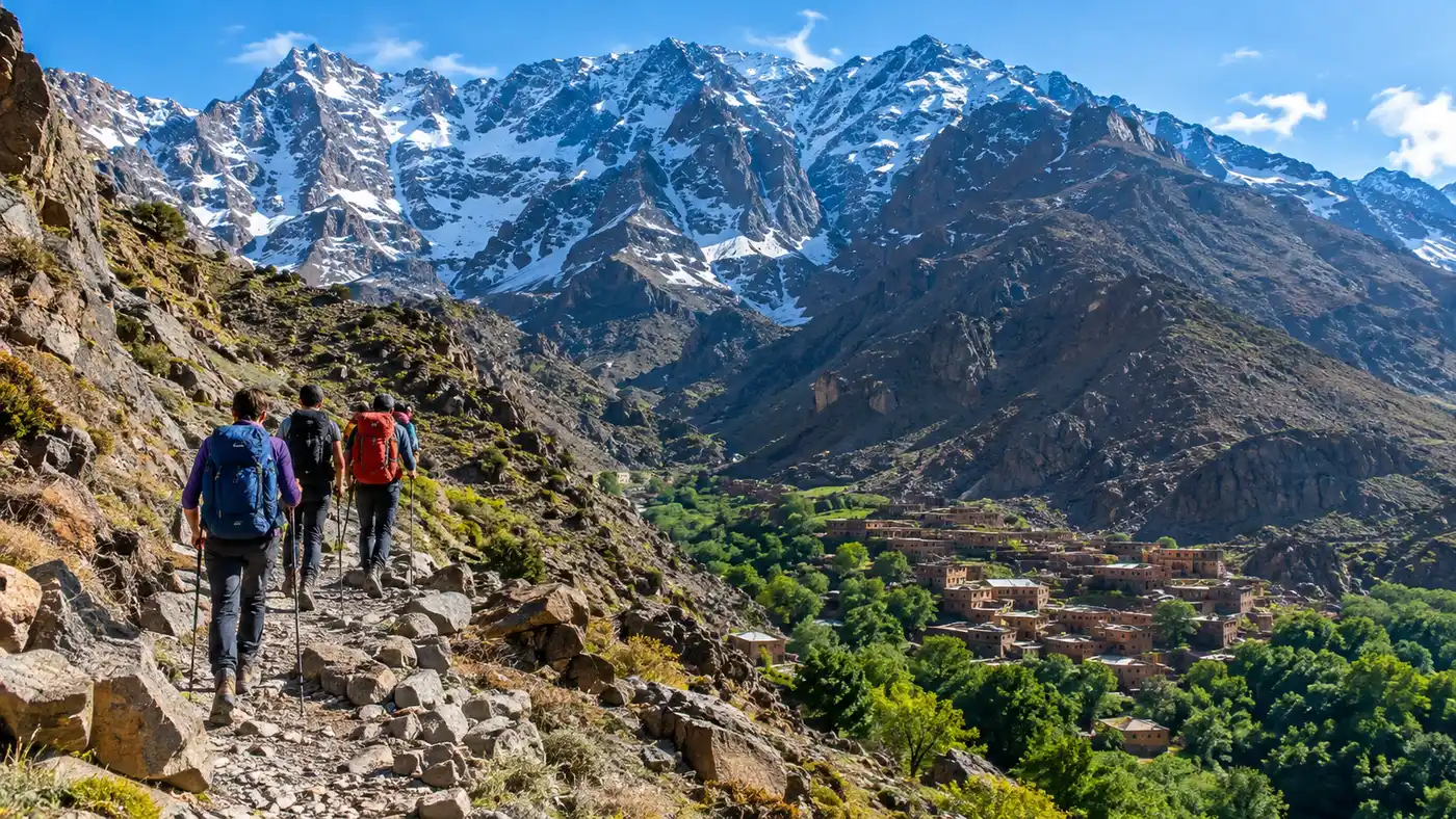
You leave Marrakech while the street sweepers are still pushing dust around the medina alleys. The air smells of diesel fumes and toasted cumin, but forty minutes south on the R203, the smog drops away and the jagged red wall of the High Atlas fills the windscreen. Setting off on a mount toubkal trek from marrakech is one of those jarring geographical shocks Morocco pulls off so well. You go from chaotic, 35-degree souks to cold mountain air in less than two hours. Most people come for the 4,167-meter summit, but the real work begins on the long approach trail winding up from the valley floor.
Getting to the top means surviving the approach first. The route from Marrakech through the village of Imlil to the base camp refuges covers roughly 1,460 meters of vertical ascent on foot. It traces ancient mule paths, cuts through walnut groves, passes a whitewashed marabout shrine, and climbs into barren, scree-choked gorges. This guide covers the entire journey to the high camp, including transport logistics, trail waypoints, gear checks, and what to actually expect when you collapse onto a bunk at 3,207 meters.
Book your mount toubkal trek experience:
Getting from Marrakech to Imlil
Imlil is the staging ground for almost every trek in the Toubkal massif. To get there on your own, head to the Bab er-Rob taxi rank just outside the southern medina walls in Marrakech. Ignore the unofficial fixers hovering near the gates and find a driver heading toward Asni. Shared grand taxis - usually beaten-up Mercedes sedans that have seen half a million kilometers - cost about 50 dirhams per seat. If you do not want to wait for the car to fill with six passengers, you can buy out the remaining spots for around 300 dirhams total, or hire a private vehicle straight to Imlil for roughly 400 dirhams.
The road climbs steadily past Tahannaout and winds through the Moulay Brahim gorge. On Saturdays, the roadside town of Asni erupts into a massive weekly market where Berbers from high villages trade sheep, grain, and plastic buckets. If your taxi ends in Asni, walk across the dusty junction to grab a local minibus or a shared pickup truck up the final 17 kilometers of switchbacks to Imlil. The road narrows here, bordered by steep drop-offs and apple orchards clinging to dry river terraces.
Note: Since late 2018, Moroccan authorities require all trekkers on Mount Toubkal to hire a licensed local mountain guide. You will pass through multiple police and gendarmerie checkpoints where officers record your passport details and verify your guide's credentials.
Most guided packages arrange private minibus transport directly from your riad, which saves the taxi hustle. If you arrange transport yourself, aim to leave Marrakech by 7:00 AM. That gets you into Imlil before 9:00 AM, leaving plenty of daylight to hike up to the refuge without rushing against an afternoon thunderstorm.
- Bab er-Rob taxi rank: best spot in Marrakech for catching shared grand taxis south toward the mountains.
- Cash preparation: pull dirhams from ATMs in Marrakech because the cash machine in Imlil runs dry frequently.
- Passport checks: keep your physical passport in an accessible pocket for the gendarmerie post at the entrance to Imlil.
Imlil: Preparing for the Trailhead
Imlil sits at 1,740 meters, tucked into a bowl where several river valleys collide. The town revolves entirely around trekking. The main street is packed with shops renting stiff plastic boots, crampons, trekking poles, and sleeping bags of varying vintage. It is noisy, bustling, and smells of wood smoke and mule dung. If your knees are already dreading the ascent, this is where you sort out logistics before your phone loses signal.
This is also where you meet your mule team if you hired one. A single mule can carry luggage for two or three hikers, usually packed into heavy woven panniers. The going rate hovers around 150 to 200 dirhams per day for the mule and the muleteer, who is often a quiet teenager from a nearby village. Muleteers do not hike at tourist pace; they load up, trot past you in a cloud of dust, and have your duffel waiting at the refuge hours before you arrive.
Pro tip: Rent a pair of sturdy trekking poles in Imlil for about 30 dirhams if you did not fly with yours. The loose granite rubble on the trail above 2,500 meters will chew up your knees without them.
Before leaving the village, grab a fresh round of crusty round bread, a wedge of La Vache Qui Rit cheese, and a few bags of dates or walnuts from the small grocers. Once you start walking past the last village houses, prices double and selection shrinks down to warm soda and candy bars. If you are debating how your stamina will hold up, reviewing the Mount Toubkal Trek Difficulty, Fitness, and Kit List can give you a clear sense of what your legs are about to endure.
The Route: From Imlil to Aroumd and Chamharouch
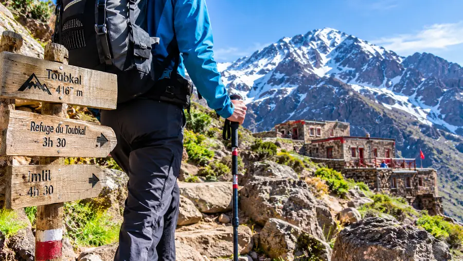
The mount toubkal trek from imlil begins along a winding dirt road that climbs past the kasbah toward the village of Aroumd. Aroumd is built directly onto a giant spur of red volcanic rock jutting out into the valley. It looks medieval. Apple and cherry orchards drop steeply to the left, irrigated by centuries-old stone channels carrying meltwater down the slopes. You walk along narrow stone lanes between flat-roofed mud-brick homes, dodge children walking down to school, and emerge onto a wide, barren riverbed.
Crossing this stony plain feels strange after the lush greenery of the lower valley. It is an enormous gravel bed left behind by ancient floods and glacial melt. Once across the dry wash, the path swings left and climbs steeply along the eastern flank of the valley. A good mount toubkal trek map shows the trail tracking the Mizane River, which stays far below on your right, roaring through a narrow bedrock slit. The gradient is steady here, rarely vicious, but you feel the heat radiating off the sun-baked granite walls.
After roughly two to three hours of walking from Imlil, you round a rocky bend and spot the white dome of Sidi Chamharouch. At 2,310 meters, this village grew around the tomb of a revered pre-Islamic spirit king, said to cure mental illness and barrenness. Non-Muslims are strictly barred from crossing the bridge to the sacred white boulder, but the cluster of stone shacks on the trekking side caters shamelessly to thirsty hikers.
Stalls here run water bottles under frigid mountain streams to keep them chilled. You can sit on a plastic chair balanced precariously on river rocks, order a glass of fresh-squeezed orange juice for 15 dirhams, and wash down the trail dust. It is a loud, surreal place where sacred pilgrims, village traders, foreign hikers, and loaded mules cross paths in a cramped river bottleneck.
Book your mount toubkal trek experience:
Pushing Upward to the Toubkal Refuge
Past Sidi Chamharouch, the trail changes personality. The trees vanish entirely. The red soil gives way to gray, fractured shale and jagged granite boulders. The valley narrows into a steep V-shape, and the wind picks up noticeably. You are now entering the high alpine zone, climbing through long, relentless switchbacks up a slope known locally as the snake path.
Every step feels slightly heavier now. The air starts thinning out past 2,800 meters, and unacclimatized lungs will notice the jump in heart rate even on mild inclines. Take small, metered steps. Many hikers blow their energy here trying to keep pace with their guide, only to burn out before the base camp comes into view. Drink water constantly; the dry mountain air pulls moisture out of your lungs with every breath.
| Trail Section | Elevation Change | Approx. Distance | Average Time |
|---|---|---|---|
| Imlil to Aroumd | 1,740m to 1,900m | 2.5 km | 45 minutes |
| Aroumd to Sidi Chamharouch | 1,900m to 2,310m | 5.5 km | 2 to 2.5 hours |
| Sidi Chamharouch to Refuge | 2,310m to 3,207m | 6.0 km | 3 to 3.5 hours |
| Total Imlil to Refuge | 1,740m to 3,207m (+1,467m) | 14 km | 5.5 to 7 hours |
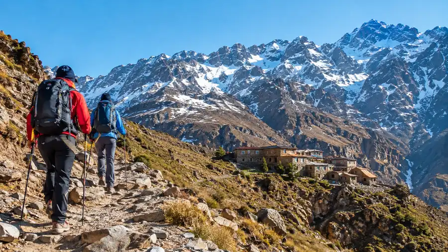
The final push is a psychological test. You climb a false ridge hoping to see the base camp, only to find another sweeping shale slope ahead. Then, suddenly, around 3,100 meters, the gray stone fortress of the toubkal refuge appears against the foot of the massif. It looks like a medieval bunker tucked beneath gigantic scree fields. You cross a narrow metal footbridge over the icy meltwater stream, drag your boots up the stone steps, and drop your pack on the terrace.
Life at the Toubkal Refuge
There are actually two buildings sitting side-by-side at 3,207 meters: the older Refuge du Toubkal (often called the CAF Refuge, run by the French Alpine Club) and Les Mouflons, a private stone lodge built a few paces away. Both provide shelter from brutal mountain winds, but neither resembles a luxury mountain hotel. They are loud, cold, functional shelters built to keep you alive and rested.
You leave all hiking boots in cubbies by the front door. The hallway is a perpetual pile of damp wool socks, heavy boots, and trekking poles. Inside, the common rooms center around heavy cast-iron wood stoves that get stoked around 5:00 PM. The air fills with the smell of damp fleece, sweet tea, and burning wood. Dinner is almost universally a giant communal platter of steaming vegetable tagine with tough beef, followed by plates of pasta and rounds of dense bread. Eat everything. You burn an absurd amount of calories just staying warm up here.
The dormitories are packed with two-tier wooden bunks lined with thick foam mattresses. There are no private rooms. You sleep shoulder-to-shoulder with strangers from across the world, serenaded by a chorus of snoring, rustling sleeping bags, and heavy breathing caused by the thin air. Blankets are provided, but they are heavy, dusty, and rarely washed; a lightweight sleeping bag or a silk liner is practically mandatory if you care about hygiene.
- Earplugs and eye mask: indispensable items if you want any sleep before your 4:00 AM summit alarm.
- Headlamp with spare batteries: electricity runs off solar and generators, shutting off entirely around 10:00 PM.
- Slippers or hut shoes: muddy boots stay at the door, and the bare stone floors are freezing cold on bare feet.
- Wet wipes and hand sanitizer: hot water showers cost extra, fail often, and freeze quickly in winter.
By 8:30 PM, the common rooms empty out. Hikers fill their Nalgene bottles with boiling water, shove them into the bottom of their sleeping bags as foot-warmers, and try to sleep. The summit looms directly above the stone walls, completely invisible in the freezing dark, waiting for the early morning push.
Frequently Asked Questions about mount toubkal trek from marrakech
Can you hike to the Toubkal refuge without a guide?
No. Moroccan regulations enacted in late 2018 require every foreign hiker to be accompanied by a certified Moroccan mountain guide. Police check your papers in Imlil and at Sidi Chamharouch, turning back anyone without a guide.
How hard is the hike from Imlil to the refuge?
The walk covers roughly 14 kilometers and climbs nearly 1,500 meters over 5 to 7 hours. While the path is wide and technically straightforward, the sheer elevation gain and thin air past 2,800 meters make it physically demanding for anyone without decent baseline cardio.
Can you charge your phone or camera at the refuge?
Yes, but sockets are limited. The refuges usually turn on generators for a few hours in the evening, leading to a scramble for wall outlets near the dining tables. Bring a portable power bank so you are not fighting over plugs.
Quick Reference
- Distance: 14 km one way
- Elevation gain: 1,467 meters
- Average hike time: 5 to 7 hours
- Starting elevation: 1,740 m (Imlil)
- Refuge elevation: 3,207 m
Book your mount toubkal trek experience:
Before You Go
The hike from the dusty alleys of Imlil to the refuge is the unheralded heart of the mountain. Take your time along the river bed, drink the cold orange juice at Chamharouch, and do not treat day one as merely a chore before the summit. Your body needs every single meter of that slow ascent to adjust to the thin Atlas air. Lace your boots tight, keep your pace slow enough to hold a conversation, and let the quiet rhythm of the mule path do its work.
Read more about mount toubkal trek.